The Method
We position "New Horizon Initiative" at the intersection of art, science and technology. We show how photography can contribute to the imagination and position of non-human life. We are using artistic research methods in which we draw on and are inspired by the knowledge of different academic fields to contribute to societal conversation on the Rights of Nature.
The starting point of the "New Horizon Initiative" method is the identification of the different stakeholders in a certain landscape. Based on scholarly research and field surveys, we look at what the interests of these stakeholders are. We create a visual inventory of different types of landscape elements (vegetation, water, infrastructure) that are important to the different stakeholders, both human and non-human. We photograph the relevant and desired landscape elements of common species, species that have disappeared and species on the IUCN Red List. All of these images form the basis for a visual stakeholder analysis, using Artificial Intelligence.
Through the lens of "machine vision," the viewer is presented with a series of idealized landscapes in which the interests of human and non-human entities are proportionally visualized. Through predictive modelling we aim to provide insights into the consequences of certain decisions on the environment.
The "New Horizon Initiative" functions as an intermediary between the artistic realm, the corporate field and the political arena. In order to promote inclusive decision-making around the 'Rights of Nature' and influence organizational and political decision-making, our goal is to be present at two platforms; literally in the boardroom through presentations of the "New Horizon Initiative" method and within the artistic domain; galleries, fine arts museums and festivals to exhibit the created images.
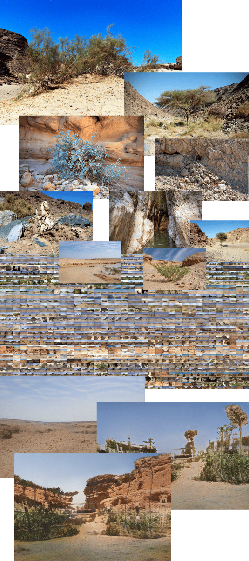
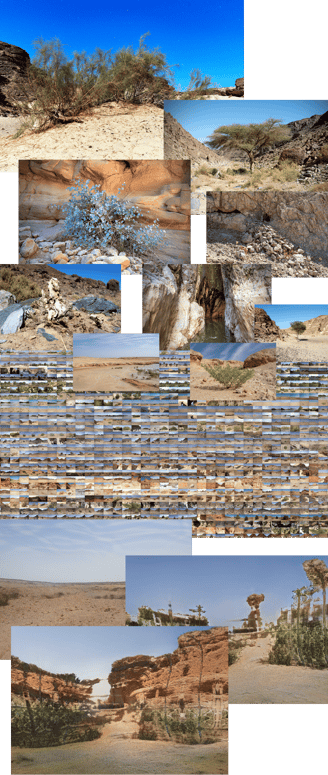
Above is an impression of the process for "Elysium Desert", our first visual stakeholder analysis that we presented at the UN Climate Change Summit (COP27) in November 2022 in Sharm-El-Sheikh, Egypt. Based on scholarly research, we created a visual inventory of different types of vegetation and landscape elements that are important for the flora and fauna, site-specific for the Sinai desert around Sharm-El-Sheikh. We looked at the needs of common species, species that have disappeared and species that are on the Red List of the IUCN. We used all of these images to do a visual stakeholder analysis through AI to forecast what the landscape can look like.
The foundational architecture from the landscape is built upon numerous datasets, which reflect the extensive 10,000 photos of field research during two visits to Egypt. All of the data has been classified into appropriate categories adhering to the hierarchy of certain types of flora and fauna site specific to that environment. Each of the data sets have been treated within a 'supervised environment', using machine learning algorithms and represent the initial building blocks to sculpt the landscape.